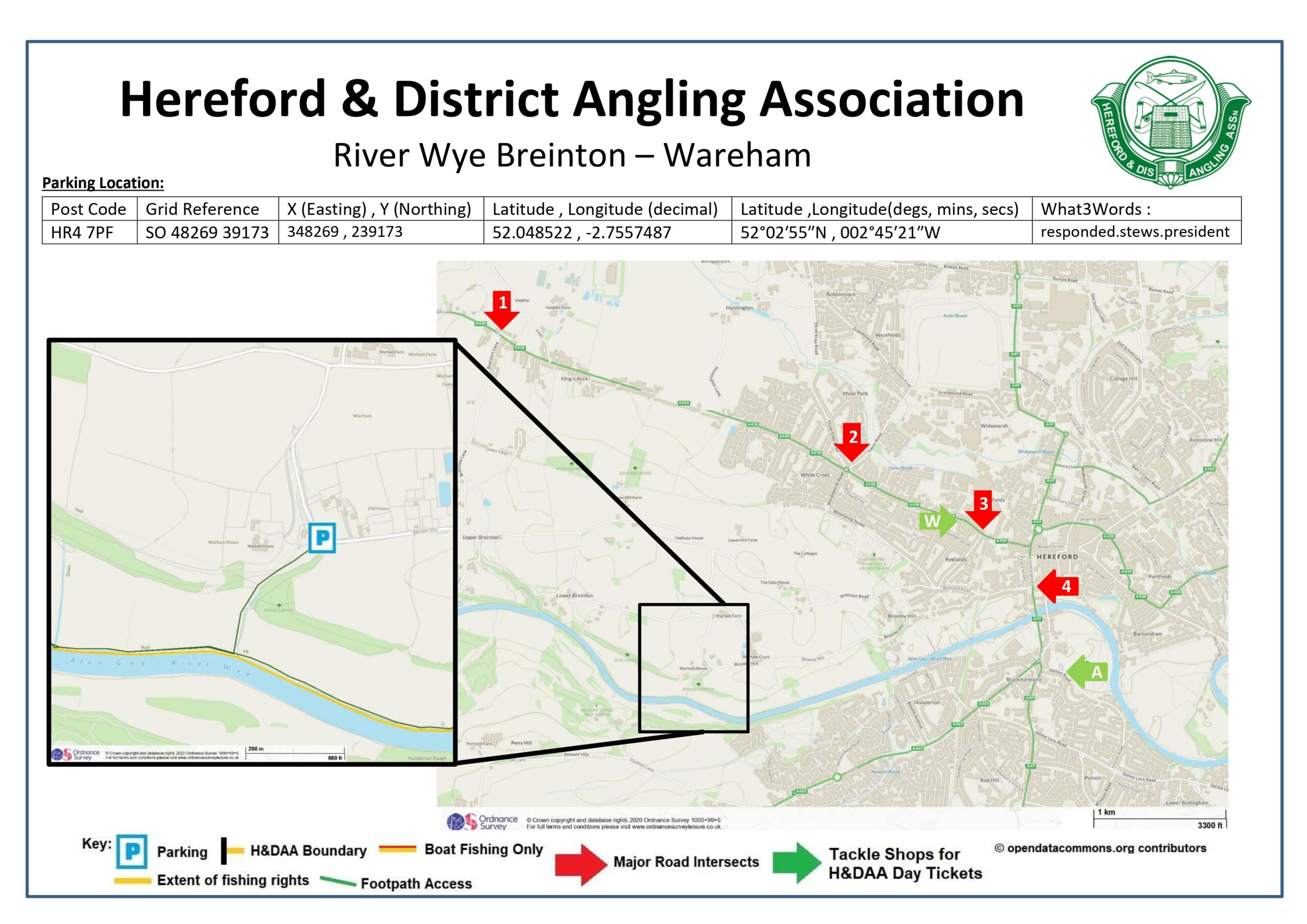
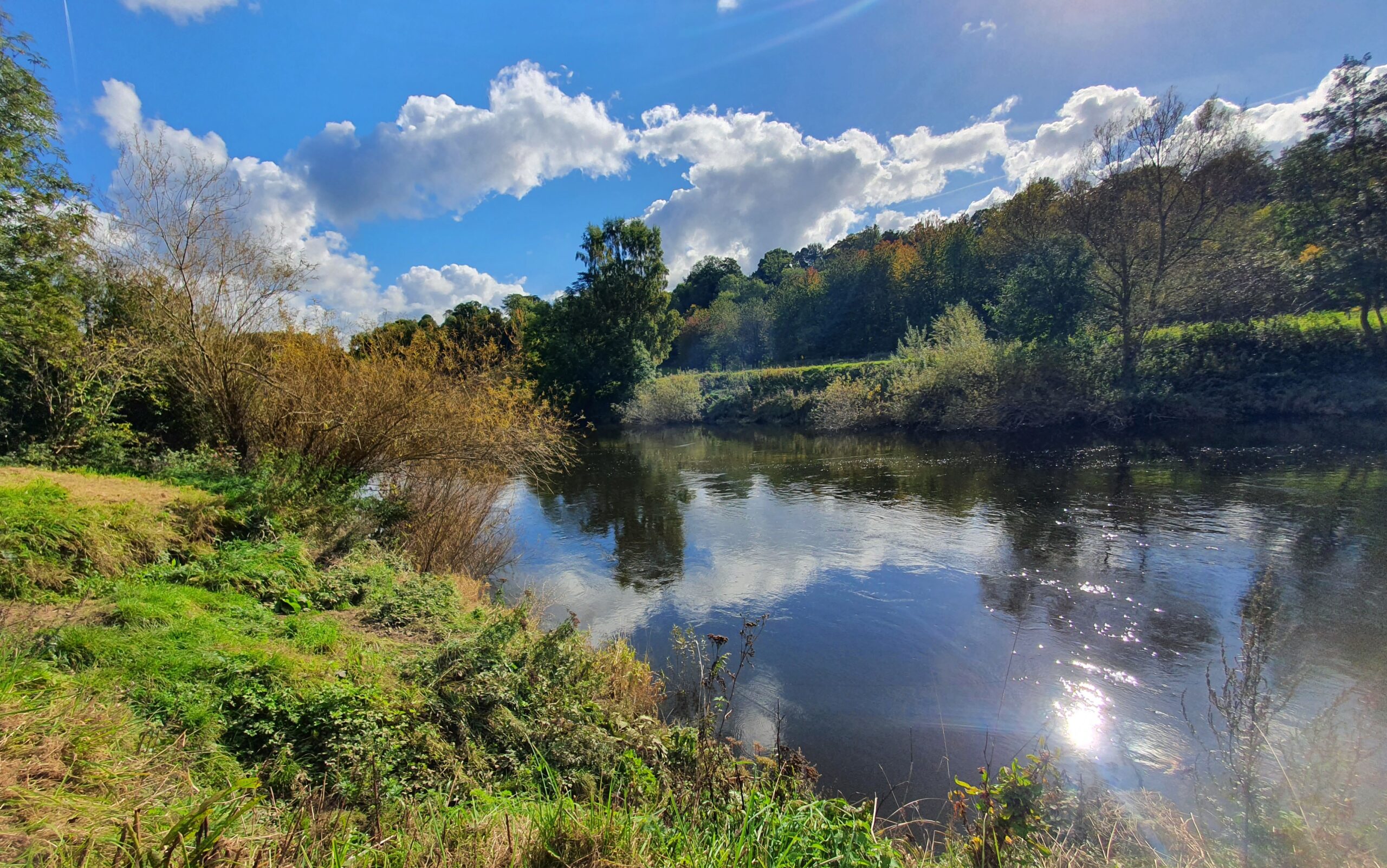
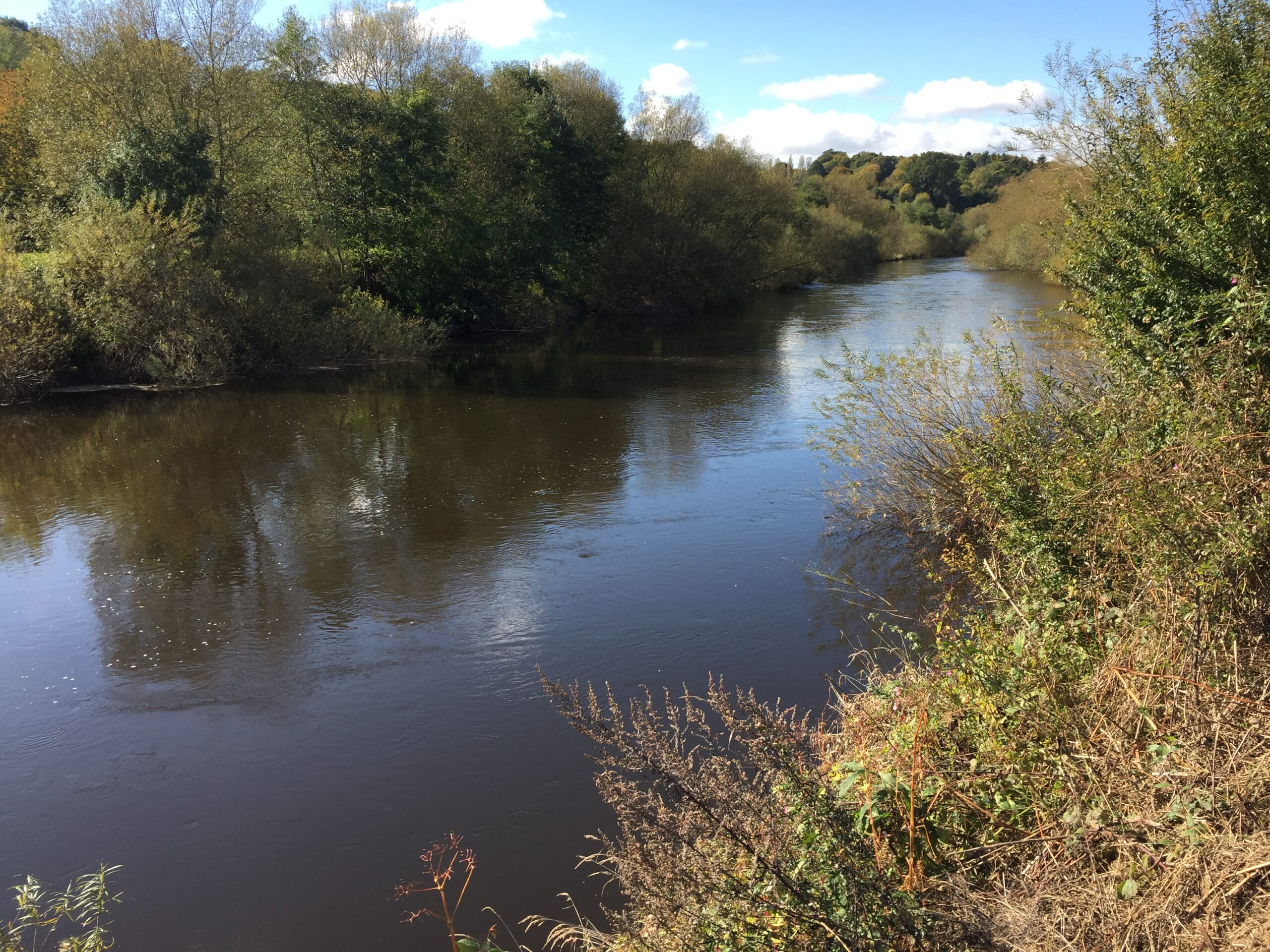
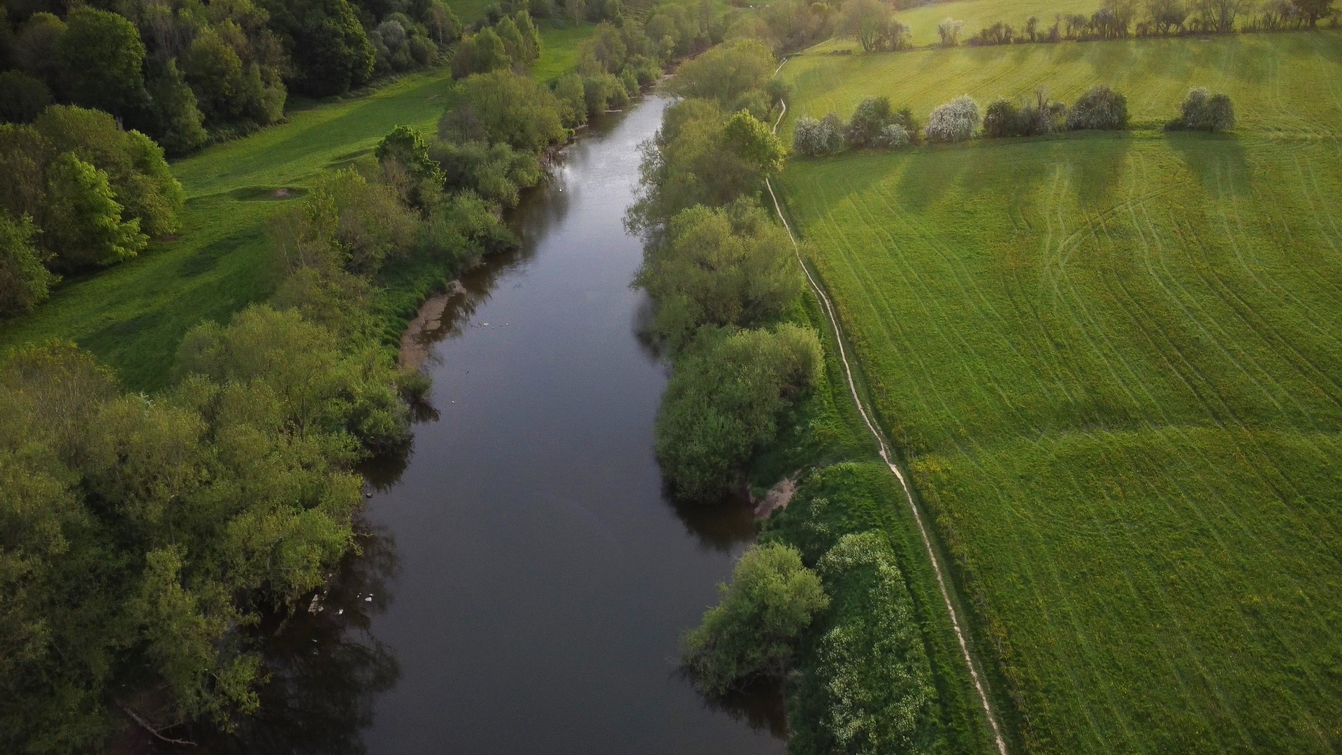
Brief description of fishery:
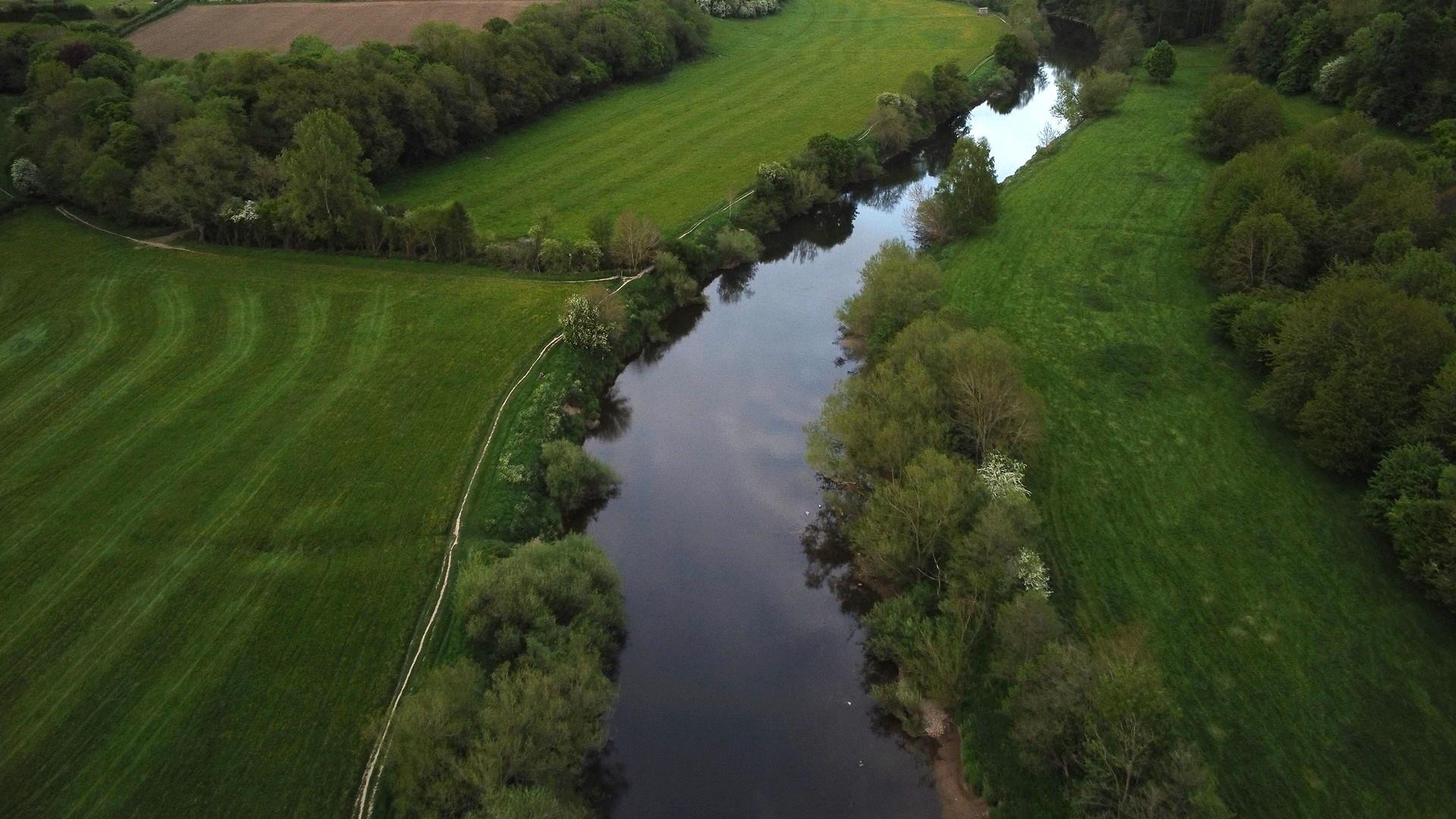
Breinton – Wareham has a mixture of shallow/fast riffles, steady runs, and some deeper pools. You can walk up to Belmont Hole at the end of the Lower Breinton stretch or downstream to permanent peg number 1 which is approximately halfway between the Pump House parking and this parking area,
Chub and Barbel are the main target species with all others present during the summer months (Dace, Roach, Bleak, Perch, Trout, Grayling & Pike). All the usual modern methods and baits work well on their day but don’t forget Maggots, Caster, Hemp, Worm, Meat & Bread are all regular producers. A roving approach or pre-baiting several areas before covering them is a good way to find the pockets of fish; alternatively speaking to the local tackle shop can shortcut this and put you on the fish based on recent catch reports.
The setting is everything you would expect of the Wye Valley however because of the valley the walk from the car park is quite steep so traveling light is
recommended. The river is approximately 340m from the Carpark.
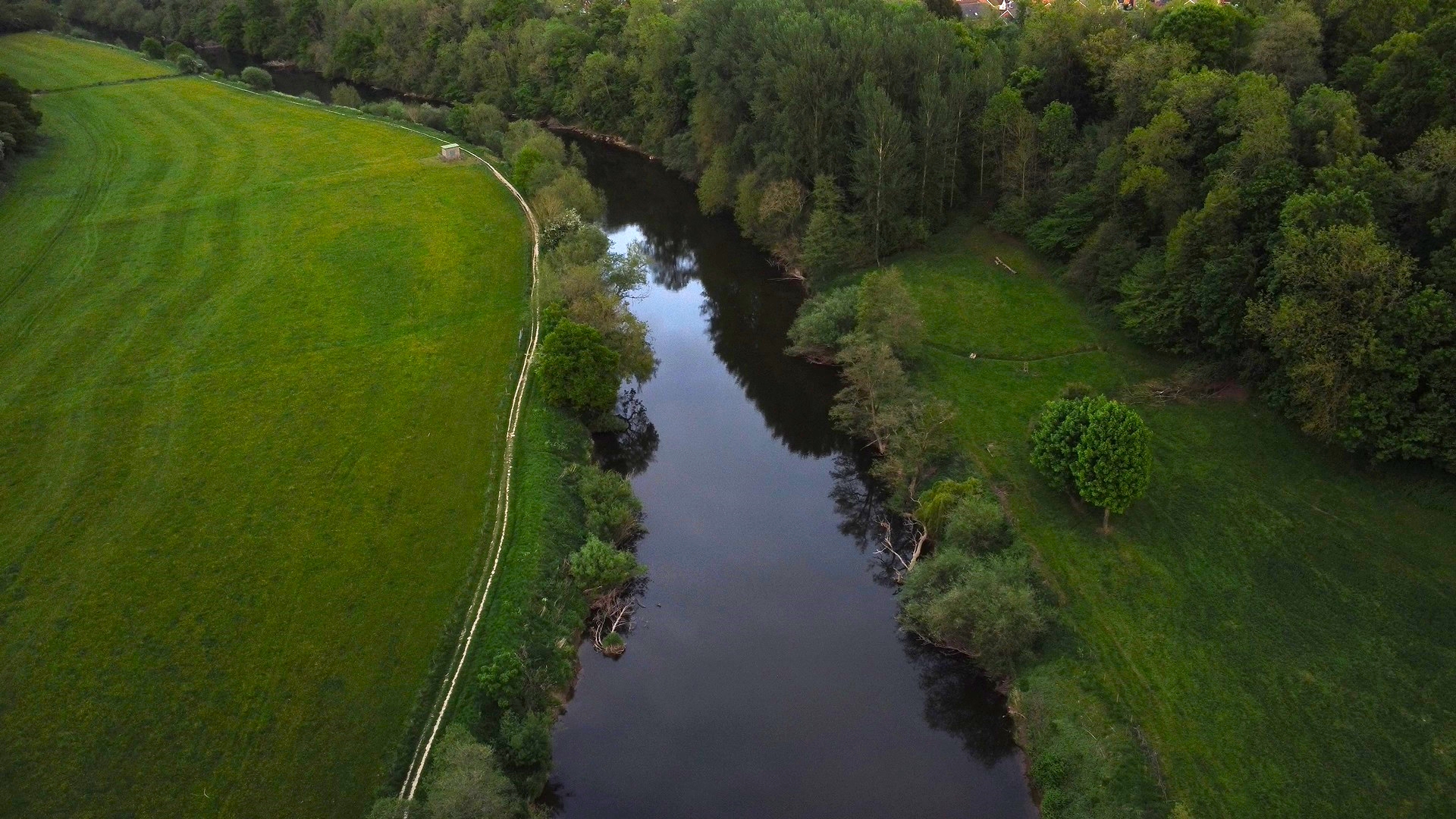
There are a few more comfortable swims in this area than at Lower Breinton however the banks are steep, and we recommend using a rope with a dog spike, particularly in damp conditions where the clay-based soil becomes very slippery. Always check the levels using the EA website and keep an eye on it during the day as they can rise high very quickly.
Address
Broomy Hill, Breinton Hereford, HR4 7PF
Post Code: HR4 7PF
Grid Reference: SO 48269 39173
X (Easting) , Y (Northing): 348269 , 239173
Latitude , Longitude (decimal): 52.048522 , -2.7557487
Latitude ,Longitude(degs, mins, secs): 52°02′55″N , 002°45′21″W
What3Words :responded.stews.president
Access & Parking
Parking is in a small layby with enough space for 5 cars parked sensibly.
When traveling north on the A49, cross Greyfriars bridge/The River Wye towards Hereford city centre. Turn left at the traffic lights at the end of the bridge into Barton Road, or if traveling south on the A49 take the right-hand lane just before the bridge and turn right into Barton Road.
Follow Barton Road over a small bridge where the Road becomes Breinton Road, turn left immediately after the bridge into Broomy Hill. Follow this lane for 1.4 miles, as the road bears sharp right you will see a small layby on the left, parking is here.
Head through the wooden kissing gate and follow the well-trodden path down to the river.
Maps


Species
- Barbel
- Bream
- Brown Trout
- Chub
- Common Carp
- Dace
- Eel
- Grayling
- Perch
- Pike
- Roach
- Salmon